Geolocate

Lock Two topographic map

Click on the map to display elevation.

About this map

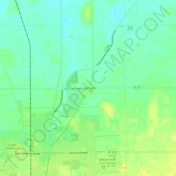
Name: Lock Two topographic map, elevation, terrain.

Location: Lock Two, Auglaize County, Ohio, 45869, United States (40.43171 -84.38912 40.47171 -84.34912)

Average elevation: 285 m

Minimum elevation: 275 m

Maximum elevation: 299 m

Other topographic maps

Click on a map to view its topography, its elevation and its terrain.

Uniopolis

United States > Ohio > Auglaize County

Average elevation: 286 m

Buckland

United States > Ohio > Auglaize County

Average elevation: 259 m

Minster

United States > Ohio > Auglaize County

Average elevation: 295 m

New Knoxville

United States > Ohio > Auglaize County

Average elevation: 276 m

Waynesfield

United States > Ohio > Auglaize County

Average elevation: 324 m

Saint Marys

United States > Ohio > Auglaize County

Average elevation: 267 m

Cridersville

United States > Ohio > Auglaize County

Average elevation: 272 m

Gear up for your next adventure:

🚲Heavy Duty Bike Lock - Secure your bike at the trailhead or during stops
💧Collapsible Water Bottle - Space-saving water bottle for outdoor activities
🥾Light Hiking Boots - Lightweight and comfortable boots for day hikes
🦌Outdoor Trail Camera - Monitor wildlife activity near your favorite spots
🪜Heavy Duty Carabiners - Multi-use clips for securing gear to your backpack

As an Amazon Associate, this site earns from qualifying purchases at no extra cost to you.