Geolocate

Truxton topographic map

Click on the map to display elevation.

About this map

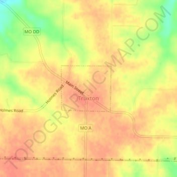
Name: Truxton topographic map, elevation, terrain.

Location: Truxton, Lincoln County, Missouri, United States (38.99995 -91.24522 39.00696 -91.23544)

Average elevation: 216 m

Minimum elevation: 183 m

Maximum elevation: 228 m

Other topographic maps

Click on a map to view its topography, its elevation and its terrain.

New Hope

United States > Missouri > Lincoln County

Average elevation: 222 m

Gear up for your next adventure:

🧦Outdoor Socks - Durable socks designed for hiking and outdoor sports
🦶Hiking Shoe Insoles - Added support for high arches and long days on feet
🥾Approach Shoes - Shoes designed for climbing approaches and rugged trails
🥾Trekking Poles - Adjustable trekking poles to reduce knee stress and improve stability
🪑Insulated Seat Pad - Protect your seat from cold rocks and wet logs

As an Amazon Associate, this site earns from qualifying purchases at no extra cost to you.