Geolocate

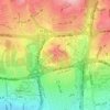
Park-e Shahr topographic map

Click on the map to display elevation.

About this map

Name: Park-e Shahr topographic map, elevation, terrain.

Location: Park-e Shahr, District 12, شهرداری منطقه شش ناحیه یک, Tehran, بخش مرکزی شهرستان تهران, Tehran County, Tehran Province, Iran (35.68116 51.40944 35.68490 51.41794)

Average elevation: 1,156 m

Minimum elevation: 1,129 m

Maximum elevation: 1,191 m

Other topographic maps

Click on a map to view its topography, its elevation and its terrain.

District 7

Iran > Tehran County > Tehran

Average elevation: 1,268 m

Kan

Iran > Tehran County > Tehran

Average elevation: 1,428 m

Tehran Vila

Iran > Tehran County > Tehran

Average elevation: 1,275 m

Hesarak

Iran > Tehran County > Tehran

Average elevation: 1,674 m

Pamenar

Iran > Tehran County > Tehran

Average elevation: 1,155 m

Shahrak Homa

Iran > Tehran County > Tehran

Average elevation: 1,387 m

Kuy Nasr

Iran > Tehran County > Tehran

Average elevation: 1,358 m

Yousef Abad

Iran > Tehran County > Tehran

Average elevation: 1,352 m

Milad Tower

Iran > Tehran County > Tehran

Average elevation: 1,394 m

District 19

Iran > Tehran County > Tehran

Average elevation: 1,102 m

Gear up for your next adventure:

🥾Mountain Hiking Shoes - Shoes with superior grip for mountainous terrain
🧢Sun Protection Cap - Breathable cap to protect from sun exposure
🧢Outdoor Visor - Breathable visor for sunny hikes
⛺Backpacking Tent - Lightweight tent for long-distance hiking trips
🧴Insect Repellent - Protect yourself from bugs during outdoor adventures

As an Amazon Associate, this site earns from qualifying purchases at no extra cost to you.