Geolocate

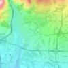
Kuy Nasr topographic map

Click on the map to display elevation.

About this map

Name: Kuy Nasr topographic map, elevation, terrain.

Location: Kuy Nasr, District 2, Tehran, بخش مرکزی شهرستان تهران, Tehran County, Tehran Province, 14455-55866, Iran (35.72497 51.36877 35.75031 51.38608)

Average elevation: 1,358 m

Minimum elevation: 1,266 m

Maximum elevation: 1,460 m

Other topographic maps

Click on a map to view its topography, its elevation and its terrain.

Pardis

Iran > Tehran County > Tehran

Average elevation: 1,336 m

رود فرحزاد

Iran > Tehran County > Tehran

Average elevation: 1,509 m

Park-e Shahr

Iran > Tehran County > Tehran

Average elevation: 1,156 m

Kan

Iran > Tehran County > Tehran

Average elevation: 1,428 m

Mellat Park

Iran > Tehran County > Tehran

Average elevation: 1,528 m

Gear up for your next adventure:

🛶Waterproof Dry Bags - Keep electronics and clothes dry during river crossings
🧥Waterproof Pants - Keep dry during rainy hiking conditions
🛁Quick-Dry Microfiber Towel - Space-saving towel that dries rapidly on the move
👟Sport Hiking Sandals - Breathable footwear for water crossings and camp rest
🛶Kayak Accessories - Essential gear for safe and fun kayaking adventures

As an Amazon Associate, this site earns from qualifying purchases at no extra cost to you.