
Make a donation
Gear up for your next adventure:
As an Amazon Associate, this site earns from qualifying purchases at no extra cost to you.
't Zwinhoekje topographic map
Click on the map to display elevation.
Make a donation
Gear up for your next adventure:
As an Amazon Associate, this site earns from qualifying purchases at no extra cost to you.
About this map
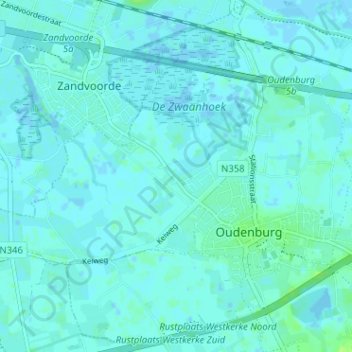
Name: 't Zwinhoekje topographic map, elevation, terrain.
Average elevation: 2 m
Minimum elevation: -3 m
Maximum elevation: 10 m
Make a donation
Gear up for your next adventure:
As an Amazon Associate, this site earns from qualifying purchases at no extra cost to you.
Other topographic maps
Click on a map to view its topography, its elevation and its terrain.
Oudenburg
België > West-Vlaanderen > Oostende > Oudenburg
Oudenburg ligt aan de rand van het West-Vlaams poldergebied op een hoogte van ongeveer 3 meter. Oudenburg ligt aan het Kanaal Plassendale-Nieuwpoort. Natuurgebieden zijn het Oostends Krekengebied, 't Pompje en Schorreweide.
Average elevation: 2 m
Westkerke
België > West-Vlaanderen > Oostende > Oudenburg
Westkerke ligt op een dekzandrug die zich op een uit het tertiair stammende getuigenheuvel heeft afgezet. De hoogte bedraagt ongeveer 8 meter. Ten zuiden van Westkerke strekt zich nog polderland uit, dat ontwaterd wordt door de Bourgognevaart en de Moerdijkvaart. De Reigerie is een vogelreservaat.
Average elevation: 4 m