Geolocate

Cerler topographic map

Click on the map to display elevation.

About this map

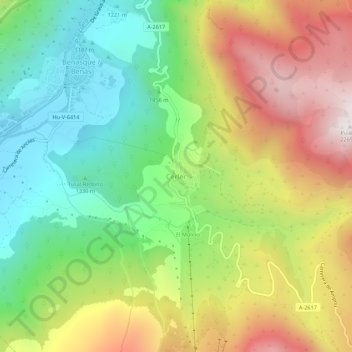
Name: Cerler topographic map, elevation, terrain.

Location: Cerler, Benasque, Ribagorza, Huesca, Aragon, 22449, Spain (42.57274 0.51842 42.61274 0.55842)

Average elevation: 1,601 m

Minimum elevation: 1,109 m

Maximum elevation: 2,271 m

Other topographic maps

Click on a map to view its topography, its elevation and its terrain.

Vallibierna

Spain > Aragon > Benasque

Average elevation: 2,276 m

Gear up for your next adventure:

🌬️Windproof Camp Stove - Efficient cooking even on exposed mountain peaks
🧦Merino Wool Socks - Moisture-wicking comfort for long-distance hiking
🧢Outdoor Cap - Protective cap for sun and rain during hikes
🦟Insect Repellent - Keep mosquitoes and black flies away in wooded areas
🔥Camping Stove - Portable stoves to cook outdoors with ease

As an Amazon Associate, this site earns from qualifying purchases at no extra cost to you.