Geolocate

Schoose topographic map

Click on the map to display elevation.

About this map

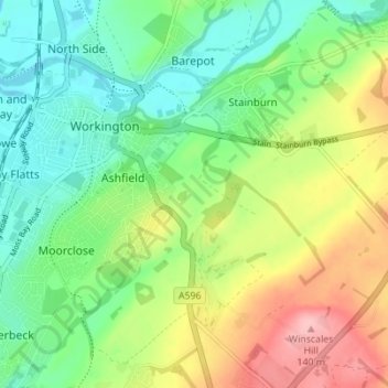
Name: Schoose topographic map, elevation, terrain.

Location: Schoose, Stainburn, Workington, Cumberland, England, CA14 4JA, United Kingdom (54.61635 -3.54935 54.65635 -3.50935)

Average elevation: 51 m

Minimum elevation: 0 m

Maximum elevation: 138 m

Other topographic maps

Click on a map to view its topography, its elevation and its terrain.

Gear up for your next adventure:

🧥Thermal Layer - Insulating layer for cold outdoor conditions
👖Convertible Hiking Pants - Zip-off legs to adapt to changing weather conditions
🛶Kayak Dry Bag - Waterproof storage for kayaking adventures
🥾Trail Hiking Shoes - Durable shoes designed for rugged trails
🛏️Camping Sleeping Mat - Comfortable mats for sleeping outdoors

As an Amazon Associate, this site earns from qualifying purchases at no extra cost to you.