
Skaftafell topographic map
Interactive map
Click on the map to display elevation.
About this map
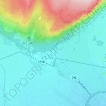
Name: Skaftafell topographic map, elevation, terrain.
Location: Skaftafell, Sveitarfélagið Hornafjörður, Suðurland, Islande (64.00645 -16.97646 64.02645 -16.95646)
Average elevation: 131 m
Minimum elevation: 77 m
Maximum elevation: 322 m
Other topographic maps
Click on a map to view its topography, its elevation and its terrain.
Lac glaciaire
Islande > Sveitarfélagið Hornafjörður
Lac glaciaire, Sveitarfélagið Hornafjörður, Austurland, Islande
Average elevation: 100 m