Geolocate

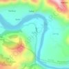
Kharun topographic map

Click on the map to display elevation.

About this map

Name: Kharun topographic map, elevation, terrain.

Location: Kharun, Karsog, Mandi, Himachal Pradesh, 175046, India (31.32264 77.08269 31.36264 77.12269)

Average elevation: 1,674 m

Minimum elevation: 1,165 m

Maximum elevation: 2,169 m

Other topographic maps

Click on a map to view its topography, its elevation and its terrain.
Bitahli Khad

India > Himachal Pradesh > Karsog

Average elevation: 1,431 m

Sunni

India > Himachal Pradesh > Karsog

Average elevation: 768 m

Sunni

India > Himachal Pradesh > Karsog

Average elevation: 768 m

Gear up for your next adventure:

🥾Hiking Gaiters - Protect legs and shoes from mud, snow, and debris
🛌Down Sleeping Bag - Superior warmth-to-weight ratio for cold nights
🍽️Titanium Camping Spork - Ultralight and indestructible eating utensil
🕯️Camping Lantern - Illuminates your entire campsite with high-efficiency LEDs
🛏️Camping Sleeping Mat - Comfortable mats for sleeping outdoors

As an Amazon Associate, this site earns from qualifying purchases at no extra cost to you.