
Bitahli Khad topographic map
Click on the map to display elevation.
About this map
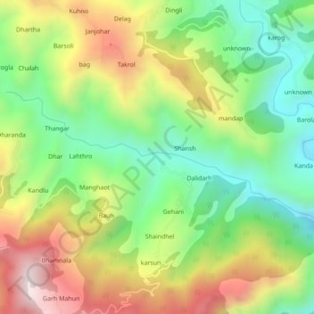
Name: Bitahli Khad topographic map, elevation, terrain.
Location: Bitahli Khad, Karsog, Mandi, Himachal Pradesh, 175010, India (31.32078 77.19928 31.33601 77.24221)
Average elevation: 1,431 m
Minimum elevation: 1,072 m
Maximum elevation: 1,926 m
Other topographic maps
Click on a map to view its topography, its elevation and its terrain.