Geolocate

Dansön topographic map

Click on the map to display elevation.

About this map

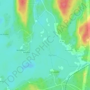
Name: Dansön topographic map, elevation, terrain.

Location: Dansön, Rämsbyn, Ludvika kommun, Dalarna County, Sweden (60.30688 15.20543 60.30737 15.20590)

Average elevation: 256 m

Minimum elevation: 237 m

Maximum elevation: 303 m

Gear up for your next adventure:

💧Hydration Pack - Hands-free hydration system for long hikes
🥾Approach Shoes - Shoes designed for climbing approaches and rugged trails
🧦Thermal Socks - Warm socks for winter hiking or camping
🦶Hiking Shoe Insoles - Added support for high arches and long days on feet
🥾All-Terrain Hiking Boots - Versatile boots for varied hiking conditions

As an Amazon Associate, this site earns from qualifying purchases at no extra cost to you.