
Loddon topographic map
Click on the map to display elevation.
About this map
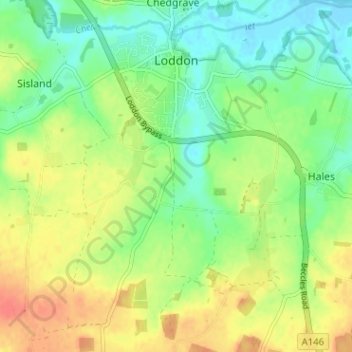
Name: Loddon topographic map, elevation, terrain.
Location: Loddon, South Norfolk, Norfolk, England, United Kingdom (52.50281 1.44761 52.54147 1.51129)
Average elevation: 20 m
Minimum elevation: -2 m
Maximum elevation: 43 m
Other topographic maps
Click on a map to view its topography, its elevation and its terrain.
Poringland Wood
United Kingdom > England > Norfolk > South Norfolk > Framingham Earl
Average elevation: 50 m
Fundenhall
United Kingdom > England > Norfolk > South Norfolk > Ashwellthorpe and Fundenhall
Average elevation: 50 m
Highoak
United Kingdom > England > Norfolk > South Norfolk > Morley St Botolph
Average elevation: 47 m
Beckhithe
United Kingdom > England > Norfolk > South Norfolk > Little Melton > Beckhithe
Average elevation: 37 m
Forncett Saint Mary
United Kingdom > England > Norfolk > South Norfolk > Forncett St Peter
Average elevation: 43 m