Geolocate

Coltishall topographic map

Click on the map to display elevation.

About this map
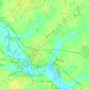
Name: Coltishall topographic map, elevation, terrain.

Location: Coltishall, Broadland, Norfolk, England, United Kingdom (52.71940 1.33753 52.75324 1.39731)

Average elevation: 13 m

Minimum elevation: -1 m

Maximum elevation: 24 m

Other topographic maps

Click on a map to view its topography, its elevation and its terrain.
Horstead

United Kingdom > England > Norfolk > Broadland > Coltishall

Average elevation: 14 m

Gear up for your next adventure:

🥾Durable Hiking Shoes - Long-lasting shoes for frequent hiking
🧴Insect Repellent - Protect yourself from bugs during outdoor adventures
🥾Trail Hiking Boots - Supportive boots for rough trails
🥾Mountain Hiking Shoes - Shoes with superior grip for mountainous terrain
🔋Lithium AA Batteries - Long-lasting power that performs in extreme cold

As an Amazon Associate, this site earns from qualifying purchases at no extra cost to you.