Geolocate

Dolishte topographic map

Click on the map to display elevation.

About this map

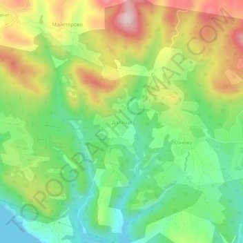
Name: Dolishte topographic map, elevation, terrain.

Location: Dolishte, Kardzhali, Bulgaria (41.65608 25.57408 41.69608 25.61408)

Average elevation: 350 m

Minimum elevation: 219 m

Maximum elevation: 536 m

Other topographic maps

Click on a map to view its topography, its elevation and its terrain.

Kirkovo

Bulgaria > Kardzhali

Average elevation: 516 m

Kardzhali

Bulgaria > Kardzhali

Average elevation: 283 m

Gear up for your next adventure:

🧢Hiking Hat - Sun-protective and breathable hats for long treks
🕯️Camping Lantern - Illuminates your entire campsite with high-efficiency LEDs
🦯Trekking Poles - Reduced impact on joints for steep topographic climbs
🧢Beanie Hat - Keep your head warm in cold weather
🧴First Aid Kit - Essential first aid supplies for outdoor emergencies

As an Amazon Associate, this site earns from qualifying purchases at no extra cost to you.