
Thank you for supporting this site ❤️
Make a donation
Make a donation
Gear up for your next adventure:
As an Amazon Associate, this site earns from qualifying purchases at no extra cost to you.
Даха topographic map
Click on the map to display elevation.
Thank you for supporting this site ❤️
Make a donation
Make a donation
Gear up for your next adventure:
As an Amazon Associate, this site earns from qualifying purchases at no extra cost to you.
About this map
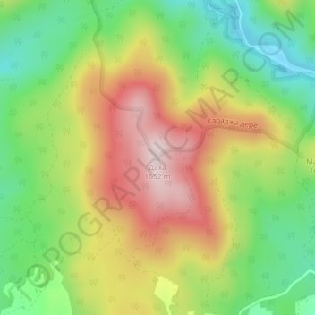
Name: Даха topographic map, elevation, terrain.
Location: Даха, Dospat, Smolyan, 4831, Bulgaria (41.66342 24.19308 41.66352 24.19318)
Average elevation: 1,435 m
Minimum elevation: 1,255 m
Maximum elevation: 1,647 m
Thank you for supporting this site ❤️
Make a donation
Make a donation
Gear up for your next adventure:
As an Amazon Associate, this site earns from qualifying purchases at no extra cost to you.