Geolocate

West Point topographic map

Click on the map to display elevation.

About this map

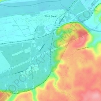
Name: West Point topographic map, elevation, terrain.

Location: West Point, Hardin County, Kentucky, United States (37.96684 -85.98628 38.00175 -85.93285)

Average elevation: 163 m

Minimum elevation: 122 m

Maximum elevation: 243 m

Other topographic maps

Click on a map to view its topography, its elevation and its terrain.

Eastview

United States > Kentucky > Hardin County

Average elevation: 231 m

Rineyville

United States > Kentucky > Hardin County

Average elevation: 242 m

Gaffey Heights

United States > Kentucky > Hardin County

Average elevation: 218 m

Limp

United States > Kentucky > Hardin County

Average elevation: 211 m

Cecil Hill

United States > Kentucky > Hardin County

Average elevation: 230 m

Kraft

United States > Kentucky > Hardin County

Average elevation: 247 m

West Point

United States > Kentucky > Hardin County > West Point

Average elevation: 169 m

Gear up for your next adventure:

🥾Trail Hiking Socks - Comfortable socks to prevent blisters and fatigue
🦟Insect Repellent - Keep mosquitoes and black flies away in wooded areas
🧢Outdoor Visor - Breathable visor for sunny hikes
🥾Lightweight Hiking Boots - Boots for comfort and mobility on long hikes
🎒Backpack Rain Cover - External shield to keep your entire pack dry

As an Amazon Associate, this site earns from qualifying purchases at no extra cost to you.