Geolocate

Thurmaston topographic map

Click on the map to display elevation.

About this map
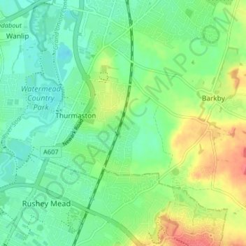
Name: Thurmaston topographic map, elevation, terrain.

Location: Thurmaston, Charnwood, Leicestershire, England, United Kingdom (52.66315 -1.11672 52.69229 -1.05124)

Average elevation: 62 m

Minimum elevation: 43 m

Maximum elevation: 96 m

Gear up for your next adventure:

🪜Heavy Duty Carabiners - Multi-use clips for securing gear to your backpack
🎒Fully Waterproof Backpack - Total protection for photography gear and electronics
🥾Mountain Trail Shoes - High-traction shoes for mountain trails
⛺Lightweight Camping Tent - Portable shelter optimized for Canadian backcountry camping
🧢Beanie Hat - Keep your head warm in cold weather

As an Amazon Associate, this site earns from qualifying purchases at no extra cost to you.