Geolocate

Tenterden topographic map

Click on the map to display elevation.

About this map
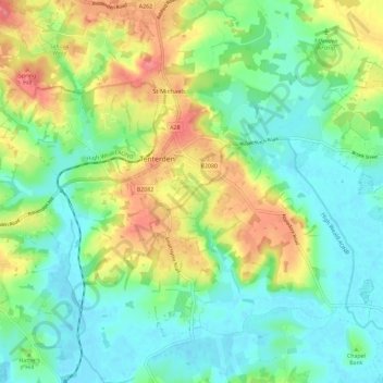
Name: Tenterden topographic map, elevation, terrain.

Location: Tenterden, Ashford, Kent, England, United Kingdom (51.02750 0.64253 51.09999 0.75704)

Average elevation: 28 m

Minimum elevation: -1 m

Maximum elevation: 78 m

Gear up for your next adventure:

🥾Hiking Gaiters - Protect legs and shoes from mud, snow, and debris
🧤Thermal Hiking Gloves - Grip-enhanced gloves for cold-weather altitude trekking
🦯Trekking Poles - Reduced impact on joints for steep topographic climbs
🎒Hiking Daypack - Lightweight and durable backpacks for day trips and excursions
🥾Mountaineering Boots - Supportive boots for climbing and high-altitude hiking

As an Amazon Associate, this site earns from qualifying purchases at no extra cost to you.