Geolocate

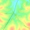
Harur topographic map

Click on the map to display elevation.

Harur

The town is in northern Tamil Nadu, with an average elevation of 350 meters (1148 feet).

Wikipedia (CC-BY-SA 3.0)

About this map

Name: Harur topographic map, elevation, terrain.

Location: Harur, Dharmapuri, Tamil Nadu, 636902, India (12.04038 78.46623 12.06694 78.48866)

Average elevation: 356 m

Minimum elevation: 336 m

Maximum elevation: 373 m

Other topographic maps

Click on a map to view its topography, its elevation and its terrain.
Morappur

India > Tamil Nadu > Harur

Average elevation: 409 m

Gear up for your next adventure:

🏃Hydration Running Vest - Carry water and maps close to your body for speed
🛏️Camping Sleeping Mat - Comfortable mats for sleeping outdoors
🧊Portable Cooler - Keep food and drinks cold during outdoor adventures
🥫Freeze-Dried Meals - Lightweight, high-calorie nutrition for multi-day treks
🔦LED Headtorch - Bright and durable light for night activities

As an Amazon Associate, this site earns from qualifying purchases at no extra cost to you.