Montrose topographic map
Click on the map to display elevation.
Montrose
Montrose occupies a position on the North Bank of Montrose Basin at the mouth of the River South Esk on the East Coast of Scotland, 11 miles (18 km) NNE of Arbroath, 19 miles (31 km) SW of Stonehaven, and 7.2 miles (12 km) ESE of Brechin. The town lies 62.2 miles (100 km) NNE of Edinburgh, and 373.2 miles (601 km) NNW of London. The built-up area occupies a roughly rectangular shape 2 miles (3 km) long by 0.75 miles (1 km) wide, aligned in a north–south orientation. The land is relatively flat, rising gradually to around 15m elevation to the North of the town.
About this map
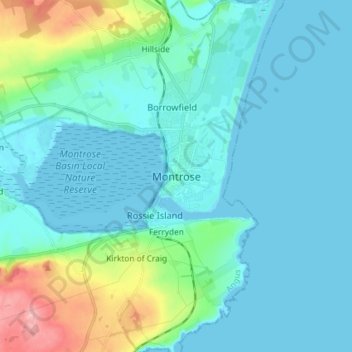
Name: Montrose topographic map, elevation, terrain.
Location: Montrose, Angus, Scotland, DD10 8QW, United Kingdom (56.67143 -2.50815 56.75143 -2.42815)
Average elevation: 22 m
Minimum elevation: -2 m
Maximum elevation: 135 m
Other topographic maps
Click on a map to view its topography, its elevation and its terrain.