
Christmas Common topographic map
Click on the map to display elevation.
Christmas Common
Christmas Common is a hamlet in Watlington civil parish, Oxfordshire about 7+1⁄2 miles (12 km) south of Thame in Oxfordshire, close to the boundary with Buckinghamshire. The hamlet is 812 feet (247 m) above sea level on an escarpment of the Chiltern Hills. Because of its elevation, Christmas Common has two radio masts that are prominent local landmarks.
About this map
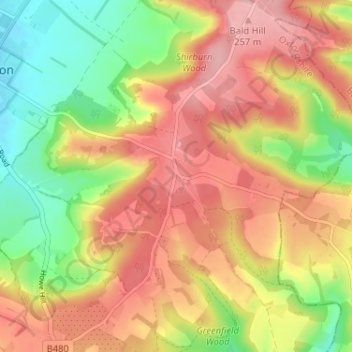
Name: Christmas Common topographic map, elevation, terrain.
Average elevation: 192 m
Minimum elevation: 112 m
Maximum elevation: 260 m
Other topographic maps
Click on a map to view its topography, its elevation and its terrain.
Watlington Hill
United Kingdom > England > Oxfordshire > South Oxfordshire > Watlington
Average elevation: 189 m