Geolocate

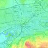
Lymm topographic map

Click on the map to display elevation.

About this map
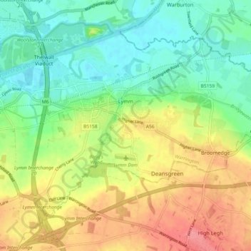
Name: Lymm topographic map, elevation, terrain.

Location: Lymm, Warrington, England, United Kingdom (53.35549 -2.51641 53.39622 -2.42538)

Average elevation: 38 m

Minimum elevation: 6 m

Maximum elevation: 82 m

Other topographic maps

Click on a map to view its topography, its elevation and its terrain.

Lymm

United Kingdom > England > Warrington

Average elevation: 31 m

Warrington

United Kingdom > England > Warrington

Average elevation: 20 m

Lately Common

United Kingdom > England > Warrington > Glazebury

Average elevation: 21 m

Appleton Thorn

United Kingdom > England > Warrington

Average elevation: 61 m

Arbury

United Kingdom > England > Warrington > Winwick

Average elevation: 22 m

Sankey Brook

United Kingdom > England > Warrington > Warrington

Average elevation: 12 m

Cuerdley Cross

United Kingdom > England > Warrington

Average elevation: 19 m

Diggle Green

United Kingdom > England > Warrington > Kenyon

Average elevation: 29 m

Hollins Green

United Kingdom > England > Warrington

Average elevation: 18 m

Burtonwood

United Kingdom > England > Warrington

Average elevation: 26 m

Gear up for your next adventure:

🧥Softshell Jacket - Windproof and breathable jacket for hiking
💧Filtered Water Bottle - Safe drinking water on the go
🦟Insect Repellent - Keep mosquitoes and black flies away in wooded areas
👟Trail Running Shoes - Agile footwear for fast-paced topographic exploration
🚲Handlebar Phone Mount - View topographic-map.com live while cycling

As an Amazon Associate, this site earns from qualifying purchases at no extra cost to you.