Geolocate

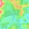
Alice Holt Forest topographic map

Click on the map to display elevation.

About this map

Name: Alice Holt Forest topographic map, elevation, terrain.

Location: Alice Holt Forest, Frith End, East Hampshire, Hampshire, England, United Kingdom (51.14890 -0.87007 51.19434 -0.82624)

Average elevation: 94 m

Minimum elevation: 54 m

Maximum elevation: 142 m

Other topographic maps

Click on a map to view its topography, its elevation and its terrain.
Gear up for your next adventure:

🥾Mountain Hiking Boots - High-traction boots for rocky terrain
⛺Lightweight Camping Tent - Portable shelter optimized for Canadian backcountry camping
🔥Camping Stove - Portable stoves to cook outdoors with ease
🧢Sun Protection Cap - Breathable cap to protect from sun exposure
💧Collapsible Water Bottle - Space-saving water bottle for outdoor activities

As an Amazon Associate, this site earns from qualifying purchases at no extra cost to you.