Geolocate

53500 topographic map

Click on the map to display elevation.

About this map

Name: 53500 topographic map, elevation, terrain.

Location: 53500, Ernée, Mayenne, Pays de la Loire, France métropolitaine, France (48.31469 -0.90853 48.31479 -0.90843)

Average elevation: 158 m

Minimum elevation: 117 m

Maximum elevation: 199 m

Other topographic maps

Click on a map to view its topography, its elevation and its terrain.
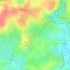
Les Bas Villiers

France > Pays de la Loire > Mayenne > Ernée

Average elevation: 137 m

Le Petit Fay

France > Pays de la Loire > Mayenne > Ernée

Average elevation: 143 m

Gear up for your next adventure:

🧦Merino Wool Socks - Moisture-wicking comfort for long-distance hiking
🥾Waterproof Trail Shoes - Shoes designed to handle wet terrain
🪑Insulated Seat Pad - Protect your seat from cold rocks and wet logs
💡Solar Camping Lamp - Eco-friendly lighting for campsites
🧢Hiking Hat - Sun-protective and breathable hats for long treks

As an Amazon Associate, this site earns from qualifying purchases at no extra cost to you.