Geolocate

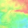
Les Bas Villiers topographic map

Click on the map to display elevation.

About this map

Name: Les Bas Villiers topographic map, elevation, terrain.

Location: Les Bas Villiers, Ernée, Mayenne, Pays de la Loire, France métropolitaine, 53500, France (48.28030 -0.96512 48.30030 -0.94512)

Average elevation: 137 m

Minimum elevation: 105 m

Maximum elevation: 182 m

Other topographic maps

Click on a map to view its topography, its elevation and its terrain.
53500

France > Pays de la Loire > Mayenne > Ernée

Average elevation: 158 m

Gear up for your next adventure:

🧢Hiking Hat - Sun-protective and breathable hats for long treks
🥾Mountain Hiking Shoes - Shoes with superior grip for mountainous terrain
🧴Outdoor Sunscreen - High SPF protection for high-altitude UV exposure
📷Outdoor Action Camera - Capture high-elevation views and rugged adventures
🦌Outdoor Trail Camera - Monitor wildlife activity near your favorite spots

As an Amazon Associate, this site earns from qualifying purchases at no extra cost to you.