Geolocate

Dar'a topographic map

Click on the map to display elevation.

About this map
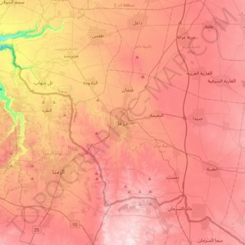
Name: Dar'a topographic map, elevation, terrain.

Location: Dar'a, Dar'a Subdistrict, Dar'a District, Dar'a Governorate, Syria (32.46278 35.94676 32.78278 36.26676)

Average elevation: 544 m

Minimum elevation: 134 m

Maximum elevation: 763 m

Other topographic maps

Click on a map to view its topography, its elevation and its terrain.

Dail

Syria > Dar'a Governorate

Average elevation: 528 m

Gear up for your next adventure:

🧰Emergency Multi-Tool - Compact multi-tool for outdoor survival
⛺Lightweight Camping Tent - Portable shelter optimized for Canadian backcountry camping
⛺Backpacking Tent - Lightweight tent for long-distance hiking trips
🔥Emergency Fire Starter - Reliable ignition source for all weather conditions
🗺️Topographic Maps - Detailed maps to explore trails, mountains, and wilderness areas

As an Amazon Associate, this site earns from qualifying purchases at no extra cost to you.