Geolocate

Comfort topographic map

Click on the map to display elevation.

About this map

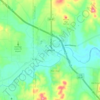
Name: Comfort topographic map, elevation, terrain.

Location: Comfort, Kendall County, Texas, 70813, United States (29.92772 -98.94503 30.00772 -98.86503)

Average elevation: 457 m

Minimum elevation: 416 m

Maximum elevation: 563 m

Other topographic maps

Click on a map to view its topography, its elevation and its terrain.

Boerne

United States > Texas > Kendall County

Average elevation: 465 m

Blackberry Creek

United States > Texas > Kendall County

Average elevation: 580 m

Boerne

United States > Texas > Kendall County

Average elevation: 465 m

Gear up for your next adventure:

🛶Canoe Life Vest - Safety vest for water sports
🧥Softshell Jacket - Windproof and breathable jacket for hiking
👟Sport Hiking Sandals - Breathable footwear for water crossings and camp rest
🥾Hiking Shorts - Breathable shorts suitable for summer hikes
🧰Multitool Knife - Compact and versatile tool for outdoor use

As an Amazon Associate, this site earns from qualifying purchases at no extra cost to you.