
Laiagam topographic map
Interactive map
Click on the map to display elevation.
About this map
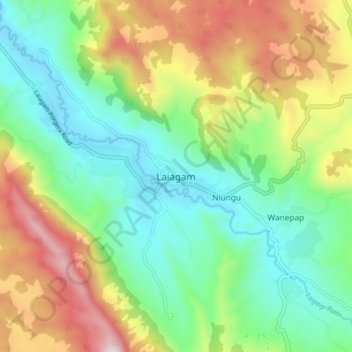
Name: Laiagam topographic map, elevation, terrain.
Location: Laiagam, Enga, Highlands Region, Papua New Guinea (-5.53349 143.44887 -5.45349 143.52887)
Average elevation: 2,473 m
Minimum elevation: 2,155 m
Maximum elevation: 3,053 m
Other topographic maps
Click on a map to view its topography, its elevation and its terrain.
Langeres
Papua New Guinea > Enga > Wabag
Langeres, Wabag, Enga, Highlands Region, Papua New Guinea
Average elevation: 2,142 m