
Langeres topographic map
Interactive map
Click on the map to display elevation.
About this map
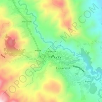
Name: Langeres topographic map, elevation, terrain.
Location: Langeres, Wabag, Enga, Highlands Region, Papua New Guinea (-5.50989 143.69969 -5.46989 143.73969)
Average elevation: 2,142 m
Minimum elevation: 1,883 m
Maximum elevation: 2,527 m