
Faisalabad City Tehsil topographic map
Interactive map
Click on the map to display elevation.
About this map
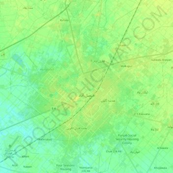
Name: Faisalabad City Tehsil topographic map, elevation, terrain.
Location: Faisalabad City Tehsil, Faisalabad District, Punjab, Pakistan (31.33564 72.99379 31.52644 73.19304)
Average elevation: 185 m
Minimum elevation: 178 m
Maximum elevation: 191 m
The soil consists of young stratified silt loam or very fine sand loam which makes the subsoil weak in structure with common kankers at only five feet. The course of the rivers within Faisalabad is winding and often subject to frequent alternations. In the rainy season, the currents are very strong. This leads to high floods in certain areas which do last for a number of days. The Rakh and Gogera canals have encouraged the water levels in the district however the belt on the Ravi River has remained narrow. The river bed does include the river channels which have shifted the sand bars and low sandy levees leading to river erosion. Faisalabad is situated at the centre of the lower Rechna Doab, the area is located between the Chenab and Ravi rivers. There is a mild slope from the northeast to the southwest with an average fall of 0.2–0.3 metres per kilometre (1.1–1.6 feet per mile). The city is situated at an elevation of about 183 metres (600 ft). The topography is marked by valleys, local depression and high ground.
Other topographic maps
Click on a map to view its topography, its elevation and its terrain.
Khudian Khas
Pakistan > Punjab > Kasur District
Khudian Khas, Kasur Tehsil, Kasur District, Lahore Division, Punjab, Pakistan
Average elevation: 192 m
Lahore District
Lahore District, Lahore Division, Punjab, Pakistan
Average elevation: 213 m
Kot Duni Chand
Kot Duni Chand, Shalimar Tehsil, Lahore District, Lahore Division, Punjab, 54850, Pakistan
Average elevation: 218 m
Mansoora Abad
Mansoora Abad, Faisalabad City Tehsil, Faisalabad District, Punjab, Pakistan
Average elevation: 187 m
Muzaffargarh
Muzaffargarh, Muzaffargarh Tehsil, Punjab, Pakistan
Average elevation: 121 m
Taxila
Pakistan > Punjab > Taxila Tehsil
Taxila, Taxila Tehsil, Rawalpindi District, Punjab, 47080, Pakistan
Average elevation: 544 m
Joggin Track Sector A1 Township
Joggin Track Sector A1 Township, Township, Lahore, Lahore District, Punjab, 54700, Pakistan
Average elevation: 214 m
Bahawalpur
Bahawalpur, Bahawalpur Tehsil, Punjab, 63100, Pakistan
Average elevation: 118 m
Chenab River
Chenab River, Gujrānwāla District, Punjab, 35460, Pakistan
Average elevation: 507 m