Geolocate

Chakwal topographic map

Click on the map to display elevation.

About this map

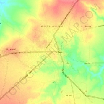
Name: Chakwal topographic map, elevation, terrain.

Location: Chakwal, Chakwal Tehsil, Punjab, 48800, Pakistan (32.77283 72.70298 33.09283 73.02298)

Average elevation: 526 m

Minimum elevation: 365 m

Maximum elevation: 1,031 m

Gear up for your next adventure:

Camping Coffee Maker - Brew fresh coffee anywhere on the topographic map
🛶Waterproof Dry Bags - Keep electronics and clothes dry during river crossings
🧥Waterproof Hiking Jacket - Protect yourself from rain and wind while hiking
📷Outdoor Action Camera - Capture high-elevation views and rugged adventures
🧴Sunscreen SPF - Broad-spectrum sunscreen for outdoor activities

As an Amazon Associate, this site earns from qualifying purchases at no extra cost to you.