Geolocate

Spaden topographic map

Click on the map to display elevation.

About this map

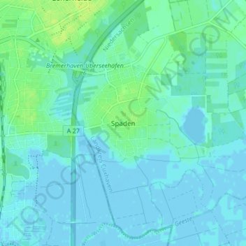
Name: Spaden topographic map, elevation, terrain.

Location: Spaden, Schiffdorf, Landkreis Cuxhaven, Lower Saxony, Germany (53.55223 8.61333 53.59223 8.65333)

Average elevation: 3 m

Minimum elevation: -3 m

Maximum elevation: 12 m

Other topographic maps

Click on a map to view its topography, its elevation and its terrain.

Gear up for your next adventure:

🛌Down Sleeping Bag - Superior warmth-to-weight ratio for cold nights
Lightweight Camping Tent - Portable shelter optimized for Canadian backcountry camping
🧥Waterproof Pants - Keep dry during rainy hiking conditions
🥾Lightweight Hiking Boots - Boots for comfort and mobility on long hikes
Bushcraft Tarp - Versatile emergency shelter or gear protection

As an Amazon Associate, this site earns from qualifying purchases at no extra cost to you.