Geolocate

Codda topographic map

Click on the map to display elevation.

About this map

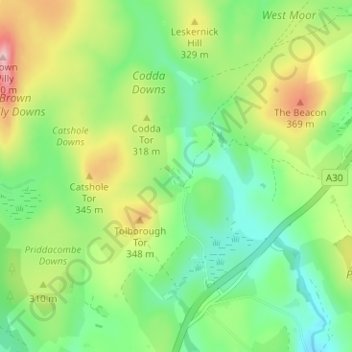
Name: Codda topographic map, elevation, terrain.

Location: Codda, Altarnun, Cornwall, England, PL15 7TJ, United Kingdom (50.55701 -4.59170 50.59701 -4.55170)

Average elevation: 289 m

Minimum elevation: 218 m

Maximum elevation: 413 m

Gear up for your next adventure:

🧥Ultralight Puffy Jacket - Maximum warmth that packs down to the size of an orange
👖Convertible Hiking Pants - Zip-off legs to adapt to changing weather conditions
🕶️Polarized Sunglasses - Protect your eyes with durable polarized lenses
🪜Heavy Duty Carabiners - Multi-use clips for securing gear to your backpack
💡LED Camping Lantern - Illuminate your campsite with long-lasting lanterns

As an Amazon Associate, this site earns from qualifying purchases at no extra cost to you.