
Gelinden topographic map
Interactive map
Click on the map to display elevation.
About this map
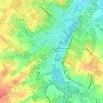
Name: Gelinden topographic map, elevation, terrain.
Location: Gelinden, Saint-Trond, Hasselt, Limbourg, Belgique (50.74890 5.23372 50.77158 5.27609)
Average elevation: 86 m
Minimum elevation: 62 m
Maximum elevation: 114 m
Other topographic maps
Click on a map to view its topography, its elevation and its terrain.
Kerckom-lez-Saint-Trond
Belgique > Limbourg > Hasselt > Saint-Trond > Kerckom-lez-Saint-Trond
Kerckom-lez-Saint-Trond, Saint-Trond, Hasselt, Limbourg, Flandre, Belgique
Average elevation: 81 m