Geolocate

Lyng topographic map

Click on the map to display elevation.

About this map

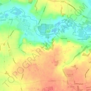
Name: Lyng topographic map, elevation, terrain.

Location: Lyng, Breckland District, Norfolk, England, United Kingdom (52.69670 1.04576 52.72724 1.10518)

Average elevation: 37 m

Minimum elevation: 10 m

Maximum elevation: 60 m

Gear up for your next adventure:

🧢Hiking Sun Hat - Wide-brimmed protection for exposed mountain ridges
🧴Sunscreen SPF - Broad-spectrum sunscreen for outdoor activities
🪑Insulated Seat Pad - Protect your seat from cold rocks and wet logs
👟Sport Hiking Sandals - Breathable footwear for water crossings and camp rest
🧴Waterproofing Spray - Restore the DWR coating on jackets and tents

As an Amazon Associate, this site earns from qualifying purchases at no extra cost to you.