
Shilin topographic map
Interactive map
Click on the map to display elevation.
About this map
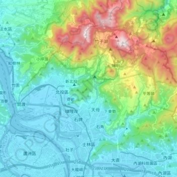
Name: Shilin topographic map, elevation, terrain.
Location: Shilin, Taipeh, Taiwan (25.07416 121.45714 25.19544 121.60784)
Average elevation: 254 m
Minimum elevation: -6 m
Maximum elevation: 1,097 m
Other topographic maps
Click on a map to view its topography, its elevation and its terrain.