
南西商圈 topographic map
Interactive map
Click on the map to display elevation.
About this map
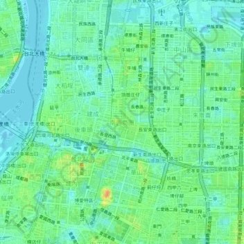
Name: 南西商圈 topographic map, elevation, terrain.
Location: 南西商圈, Taipeh, 104002, Taiwan (25.03231 121.50238 25.07231 121.54238)
Average elevation: 12 m
Minimum elevation: -1 m
Maximum elevation: 36 m
Other topographic maps
Click on a map to view its topography, its elevation and its terrain.