Geolocate

Lorenzo topographic map

Click on the map to display elevation.

About this map

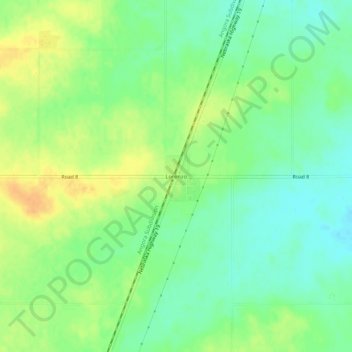
Name: Lorenzo topographic map, elevation, terrain.

Location: Lorenzo, Cheyenne County, Nebraska, United States (41.02753 -103.08788 41.06753 -103.04788)

Average elevation: 1,334 m

Minimum elevation: 1,319 m

Maximum elevation: 1,351 m

Other topographic maps

Click on a map to view its topography, its elevation and its terrain.

Potter

United States > Nebraska > Cheyenne County

Average elevation: 1,350 m

Dalton

United States > Nebraska > Cheyenne County > Dalton

Average elevation: 1,300 m

Gear up for your next adventure:

🧥Waterproof Pants - Keep dry during rainy hiking conditions
💧Hydration Pack - Hands-free hydration system for long hikes
🌡️Emergency Mylar Blankets - Compact thermal protection for unexpected nights outdoors
🥾Trail Hiking Shoes - Durable shoes designed for rugged trails
👖Convertible Hiking Pants - Zip-off legs to adapt to changing weather conditions

As an Amazon Associate, this site earns from qualifying purchases at no extra cost to you.