Geolocate

Dalton topographic map

Click on the map to display elevation.

About this map

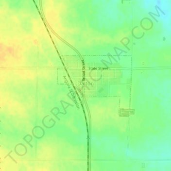
Name: Dalton topographic map, elevation, terrain.

Location: Dalton, Cheyenne County, Nebraska, 69131, United States (41.40211 -102.97971 41.41167 -102.96408)

Average elevation: 1,300 m

Minimum elevation: 1,285 m

Maximum elevation: 1,311 m

Gear up for your next adventure:

🧥Softshell Jacket - Windproof and breathable jacket for hiking
👖Convertible Hiking Pants - Zip-off legs to adapt to changing weather conditions
🔪Outdoor Multitool - Versatile tool for repairs and food prep in the wild
💧Reusable Water Bottle - Durable water bottles for hydration on trails
Camping Tent - Weather-resistant tents suitable for 2 to 6 people

As an Amazon Associate, this site earns from qualifying purchases at no extra cost to you.