
Major County topographic map
Click on the map to display elevation.
About this map
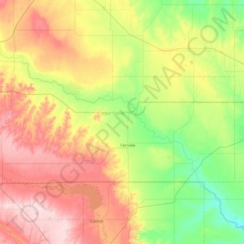
Name: Major County topographic map, elevation, terrain.
Location: Major County, Oklahoma, United States (36.16125 -98.96064 36.50710 -98.10364)
Average elevation: 436 m
Minimum elevation: 325 m
Maximum elevation: 604 m
Other topographic maps
Click on a map to view its topography, its elevation and its terrain.
Southwest Oklahoma City Sludge Lagoon Dam
United States > Oklahoma > Cleveland County > Oklahoma City
Average elevation: 348 m
Lake Thunderbird Dam
United States > Oklahoma > Cleveland County > Norman > Little Axe
Average elevation: 318 m