
Harrigan Cove topographic map
Interactive map
Click on the map to display elevation.
About this map
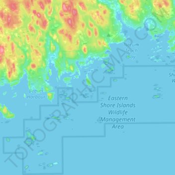
Name: Harrigan Cove topographic map, elevation, terrain.
Average elevation: 12 m
Minimum elevation: -1 m
Maximum elevation: 95 m
Halifax County trails, hiking, mountain biking, running and outdoor activities
Other topographic maps
Click on a map to view its topography, its elevation and its terrain.
Ponhook Cove
Canada > Nova Scotia > Halifax County > Head of St. Margarets Bay
Average elevation: 130 m
Eastern Shore District High School Park
Canada > Nova Scotia > Halifax County > Musquodoboit Harbour
Average elevation: 24 m
Musquodoboit River
Canada > Nova Scotia > Halifax County > Middle Musquodoboit
Average elevation: 50 m