
Schliersee topographic map
Interactive map
Click on the map to display elevation.
Schliersee
Schliersee is located on the northeastern shore of the lake of the same name and is a well known resort in the Bavarian Alps. Schliersee provides scenic views of the surrounding mountains, in particular Aiplspitz, Jägerkamp (German), Brecherspitz and Bodenschneid, all belonging to the Mangfallgebirge range. The Spitzingsee area is at an elevation of 1,090 meters high and is a well known winter sports and mountain hiking centre.
About this map
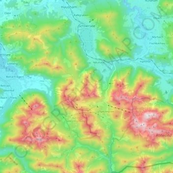
Name: Schliersee topographic map, elevation, terrain.
Location: Schliersee, Landkreis Miesbach, Bavaria, 83727, Germany (47.60823 11.79350 47.75662 11.94251)
Average elevation: 1,079 m
Minimum elevation: 712 m
Maximum elevation: 1,866 m
Other topographic maps
Click on a map to view its topography, its elevation and its terrain.