Geolocate

Buch topographic map

Click on the map to display elevation.

About this map

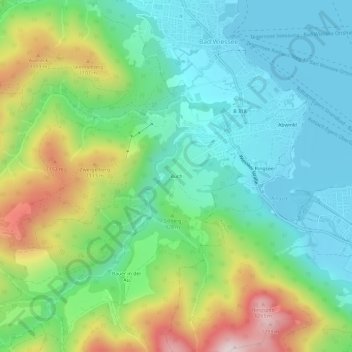
Name: Buch topographic map, elevation, terrain.

Location: Buch, Bad Wiessee, Landkreis Miesbach, Bavaria, 83707, Germany (47.67748 11.69839 47.71748 11.73839)

Average elevation: 904 m

Minimum elevation: 723 m

Maximum elevation: 1,307 m

Gear up for your next adventure:

🥾Mountaineering Boots - Supportive boots for climbing and high-altitude hiking
🥾Hiking Leggings - Comfortable leggings for outdoor activities
🧥Fleece Jacket - Warm and lightweight jacket for layering
👖Convertible Hiking Pants - Zip-off legs to adapt to changing weather conditions
❄️Traction Ice Cleats - Slip-on spikes for icy trails and winter hiking

As an Amazon Associate, this site earns from qualifying purchases at no extra cost to you.