Geolocate

Floiger topographic map

Click on the map to display elevation.

About this map

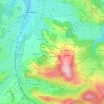
Name: Floiger topographic map, elevation, terrain.

Location: Floiger, Miesbach, Landkreis Miesbach, Bavaria, 83714, Germany (47.75475 11.82480 47.79475 11.86480)

Average elevation: 769 m

Minimum elevation: 683 m

Maximum elevation: 925 m

Gear up for your next adventure:

🧭GPS Tracker - Track your location in remote areas safely
🛶Waterproof Dry Bags - Keep electronics and clothes dry during river crossings
🧦Outdoor Socks - Durable socks designed for hiking and outdoor sports
🧭GPS Outdoor Watch - Smart watch for navigation and fitness tracking in nature
🔭Outdoor Binoculars - Lightweight binoculars for birdwatching and hiking

As an Amazon Associate, this site earns from qualifying purchases at no extra cost to you.