Geolocate

Uling topographic map

Click on the map to display elevation.

About this map

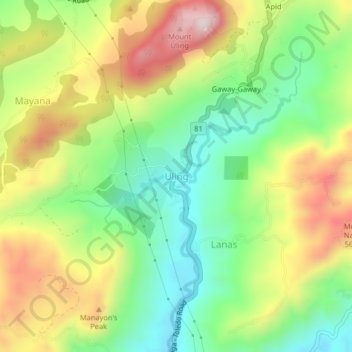
Name: Uling topographic map, elevation, terrain.

Location: Uling, Cebu, Central Visayas, Philippines (10.26022 123.69134 10.30022 123.73134)

Average elevation: 314 m

Minimum elevation: 94 m

Maximum elevation: 613 m

Gear up for your next adventure:

🧊Insulated Water Bottle - Keeps drinks cold in summer and prevents freezing in winter
🎒Fully Waterproof Backpack - Total protection for photography gear and electronics
🔪Outdoor Multitool - Versatile tool for repairs and food prep in the wild
Backpacking Tent - Lightweight tent for long-distance hiking trips
🧤Thermal Hiking Gloves - Grip-enhanced gloves for cold-weather altitude trekking

As an Amazon Associate, this site earns from qualifying purchases at no extra cost to you.