Geolocate

Shell Knob topographic map

Click on the map to display elevation.

About this map

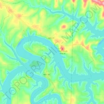
Name: Shell Knob topographic map, elevation, terrain.

Location: Shell Knob, Barry County, Missouri, United States (36.57032 -93.64132 36.64041 -93.56318)

Average elevation: 306 m

Minimum elevation: 268 m

Maximum elevation: 406 m

Other topographic maps

Click on a map to view its topography, its elevation and its terrain.

McDowell

United States > Missouri > Barry County

Average elevation: 385 m

Eagle Rock

United States > Missouri > Barry County

Average elevation: 322 m

Gear up for your next adventure:

🧶550 Survival Paracord - Versatile utility cord for emergency repairs and rigging
🦶Hiking Shoe Insoles - Added support for high arches and long days on feet
❄️Traction Ice Cleats - Slip-on spikes for icy trails and winter hiking
🥾Waterproof Hiking Boots - Essential footwear for rugged terrain and wet Canadian trails
🩹Moleskin Blister Pads - Direct protection for painful foot pressure points

As an Amazon Associate, this site earns from qualifying purchases at no extra cost to you.