
Lauderdale Lakes topographic map
Interactive map
Click on the map to display elevation.
About this map
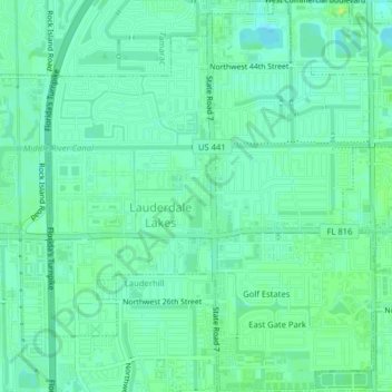
Name: Lauderdale Lakes topographic map, elevation, terrain.
Location: Lauderdale Lakes, Broward County, Florida, United States (26.15059 -80.21997 26.18621 -80.18292)
Average elevation: 6 m
Minimum elevation: 0 m
Maximum elevation: 12 m
Other topographic maps
Click on a map to view its topography, its elevation and its terrain.
Middle River Vista
United States > Florida > Broward County > Fort Lauderdale
Middle River Vista, Fort Lauderdale, Broward County, Florida, 33311, United States
Average elevation: 7 m
Hollywood
United States > Florida > Broward County
Hollywood, Broward County, Florida, United States
Average elevation: 5 m
Cooper City
United States > Florida > Broward County
Cooper City, Broward County, Florida, United States
Average elevation: 6 m
Weston
United States > Florida > Broward County > Weston
Weston, Broward County, Florida, United States
Average elevation: 5 m
Margate
United States > Florida > Broward County
Margate, Broward County, Florida, 33063, United States
Average elevation: 7 m
Coral Springs
United States > Florida > Broward County
Coral Springs, Broward County, Florida, United States
Average elevation: 6 m
Pompano Beach
United States > Florida > Broward County > Pompano Beach
Pompano Beach, Broward County, Florida, United States
Average elevation: 6 m
Palm Aire
United States > Florida > Broward County > Fort Lauderdale > Palm Aire
Palm Aire, Fort Lauderdale, Broward County, Florida, 33309, United States
Average elevation: 6 m
Lakeview
United States > Florida > Broward County > Deerfield Beach > Lakeview
Lakeview, Deerfield Beach, Broward County, Florida, 33442, United States
Average elevation: 8 m
Lauderdale-by-the-Sea
United States > Florida > Broward County > Lauderdale-by-the-Sea
Lauderdale-by-the-Sea, Broward County, Florida, United States
Average elevation: 4 m
Parkland
United States > Florida > Broward County
Parkland, Broward County, Florida, United States
Average elevation: 7 m
Davie
United States > Florida > Broward County > Sunrise
Davie, Sunrise, Broward County, Florida, United States
Average elevation: 6 m
Deerfield Beach
United States > Florida > Broward County
Deerfield Beach, Broward County, Florida, United States
Average elevation: 5 m
Sunrise
United States > Florida > Broward County
Sunrise, Broward County, Florida, United States
Average elevation: 5 m