
Farley Wood topographic map
Interactive map
Click on the map to display elevation.
About this map
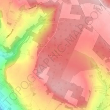
Name: Farley Wood topographic map, elevation, terrain.
Average elevation: 255 m
Minimum elevation: 101 m
Maximum elevation: 315 m
Other topographic maps
Click on a map to view its topography, its elevation and its terrain.
Starkholmes
United Kingdom > England > Derbyshire > Derbyshire Dales > Matlock
Starkholmes, Matlock Town CP, Matlock, Derbyshire Dales, Derbyshire, England, DE4 5JB, United Kingdom
Average elevation: 175 m
Riber Castle
United Kingdom > England > Derbyshire > Derbyshire Dales > Matlock > Starkholmes
Riber Castle, Cross Lane, Starkholmes, Matlock Town CP, Matlock, Derbyshire Dales, Derbyshire, England, DE4 5JD, United Kingdom
Average elevation: 169 m