Geolocate

Cortes topographic map

Click on the map to display elevation.

About this map
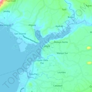
Name: Cortes topographic map, elevation, terrain.

Location: Cortes, Bohol, Central Visayas, 6330, Philippines (9.68248 123.83918 9.76248 123.91918)

Average elevation: 31 m

Minimum elevation: -4 m

Maximum elevation: 262 m

Other topographic maps

Click on a map to view its topography, its elevation and its terrain.
Boyo-an

Philippines > Bohol > Candijay

Average elevation: 43 m

Bingag

Philippines > Bohol > Dauis

Average elevation: 19 m

Gear up for your next adventure:

🧭GPS Tracker - Track your location in remote areas safely
🥾Trail Hiking Boots - Supportive boots for rough trails
🧣Merino Neck Gaiter - Protects against wind, sun, and cold at high altitudes
🥾Mountain Hiking Shoes - Shoes with superior grip for mountainous terrain
🧥Thermal Fleece Jacket - Versatile insulation for changing mountain temperatures

As an Amazon Associate, this site earns from qualifying purchases at no extra cost to you.