Geolocate

Boyo-an topographic map

Click on the map to display elevation.

About this map

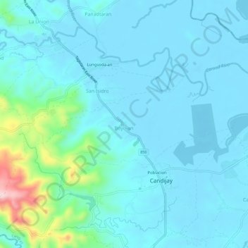
Name: Boyo-an topographic map, elevation, terrain.

Location: Boyo-an, Candijay, Bohol, Central Visayas, Philippines (9.81684 124.46745 9.84412 124.52393)

Average elevation: 43 m

Minimum elevation: -5 m

Maximum elevation: 326 m

Gear up for your next adventure:

🛁Quick-Dry Microfiber Towel - Space-saving towel that dries rapidly on the move
💧Collapsible Water Bottle - Space-saving water bottle for outdoor activities
🧥Waterproof Hiking Jacket - Protect yourself from rain and wind while hiking
Bushcraft Tarp - Versatile emergency shelter or gear protection
🩹Compact First Aid Kit - Pre-packed essentials for common trail injuries

As an Amazon Associate, this site earns from qualifying purchases at no extra cost to you.